

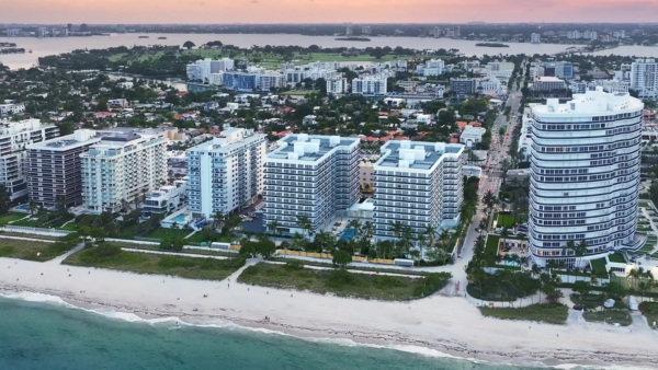
Cities don’t arrive at their skylines in any sudden or dramatic way. The outline we associate with them, the mix of towers, older rooftops, newer glass volumes, is shaped gradually, through decisions that stretch across years. Height permissions get negotiated. Zoning rules shift. Infrastructure plans intervene. Developers push for visibility while municipalities push back for balance. Long before anything reaches construction, there is already a quiet process of testing how each addition might alter the city’s profile. This is where architectural rendering starts to matter in a very practical sense. It gives planners and architects something more concrete than drawings to evaluate, a way to see how a future structure might sit against what already exists, before it begins to change the skyline in physical terms.
Seeing Buildings in Context, Not Isolation
A single building rarely reshapes a skyline on its own. Its impact depends on what surrounds it. A tower rising beside low historic blocks carries a different visual weight than one placed within an established high-rise cluster. Traditional drawings communicate dimensions and structure, but they do not fully convey presence.
3D rendering changes the way projects get judged. Instead of reviewing a building on its own, planners can see it placed inside the actual city fabric, next to the streets and structures it will live among. The view from a riverside, a square, or a main traffic route can be checked early rather than imagined. That broader visual reference helps reveal whether a proposal sits naturally within its surroundings or feels visually disruptive before construction begins.
Testing Height, Density, and Massing
Urban architecture is shaped as much by limits as by ambition. Height caps, setback rules, and density allowances are meant to protect daylight, infrastructure load, and the broader character of a city. On drawings, though, those controls often stay theoretical.
3D rendering makes it easier to test how those limits actually play out. A tower can be pushed higher to see what it does to the surrounding scale. Density can be spread across several mid-rise volumes instead of concentrated in one vertical statement. Different arrangements can be reviewed side by side rather than debated in abstract terms.
Seen this way, comparisons move beyond compliance. The skyline starts to read less like a collection of isolated approvals and more like something intentionally composed.
Daylight, Shadow, and Environmental Impact
Skylines are not only read from afar. Their effects are felt on the ground. Tall buildings stretch shadows across streets, shift wind movement, and change how daylight reaches surrounding homes and public areas.
This is where architectural visualization starts carrying practical weight. With environmental simulation added, planners can follow shadow paths across seasons, not just fixed hours. Parks, plazas, and residential courtyards can be reviewed for sun access before anything is built. Airflow between dense towers can also be tested, revealing where downdrafts or wind tunnels may form.
Used this way, 3D rendering supports vertical growth without overlooking comfort at street level.
Materiality and Urban Identity
A skyline is not defined by shape alone. Surface treatment plays an equally powerful role. Glass-heavy districts reflect light differently from stone-dominated historic cores. Metal cladding, terracotta facades, and composite panels each alter how a building reads from distance and proximity.
CGI enables architects to test these material expressions within broader city palettes. A reflective curtain wall may feel appropriate in a financial district but disruptive in a heritage zone. Color tones, facade articulation, and nighttime illumination strategies can all be reviewed visually before commitments are made.
This process helps cities maintain coherence even as architectural styles evolve.
Integrating Infrastructure and Public Space
Urban architecture does not end where a building stops. The spaces around it carry their own weight. Transit stations, pedestrian crossings, waterfront routes, raised walkways, public squares. They shape how a skyline functions once people begin moving through it, not just how it reads from afar.
This is where CGI starts pulling wider context into view. Towers are no longer reviewed on their own. You see how they sit against transport lines, how large podium bases meet the street, how circulation actually works at ground level. Elements like planted roofs, stepped terraces, or landscaped setbacks begin to register less as features and more as transitions between dense construction and shared public space.
Communicating Vision to the Public
Few urban developments move forward without public scrutiny. Residents want to understand how new construction will affect views, property values, traffic, and neighborhood character. Technical drawings rarely answer those concerns effectively.
Photorealistic CGI has become central to public consultations. It translates planning proposals into imagery people can react to emotionally and practically. Residents can see how a waterfront might look after redevelopment or how a new tower cluster will appear from familiar streets.
This transparency does not eliminate opposition, but it grounds debate in shared visual evidence rather than speculation.
Supporting Investment and Development Decisions
Large urban projects require significant capital, often secured before construction begins. Investors and development partners rely on visual projections to evaluate feasibility and market appeal.
3D rendering supports these conversations by illustrating how projects will present within the cityscape. Marketing imagery frequently evolves from planning visualizations, bridging early design stages with later promotional campaigns. While the intent shifts from planning to sales, the visual foundation remains consistent.
This continuity reinforces confidence across financial and development stakeholders.
Exploring Future Urban Scenarios
One of the more forward-looking uses of 3D rendering shows up when cities start thinking beyond immediate projects. Population pressure, climate strain, the slow fading of industrial districts.
Some of these ideas start out sounding distant. Car-free districts, former industrial land turned residential, towers wrapped in greenery. On paper, they remain abstract for a long time. It is only once they are visualized that their scale and impact become easier to judge. Architectural 3D rendering gives planning teams a way to look at those shifts in a more grounded way, seeing how they might sit inside the existing city rather than discussing them as policy language alone.
Work at this stage rarely stays theoretical. It tends to feed into zoning adjustments and infrastructure planning long before cranes or construction timelines enter the picture.
A Skyline Designed Long Before It Rises
What we recognize as a city skyline is the visible outcome of countless invisible reviews. Massing debates, material studies, shadow analyses, and public consultations shape it long before cranes appear.
Architectural rendering sits at the center of that process. It aligns vision across disciplines, tests environmental consequences, and communicates change to the public with clarity. By allowing cities to preview their horizons before they materialize, it turns skyline design from reactive growth into deliberate composition.
Tomorrow’s skylines, in that sense, are already being drawn. Not just in plans and regulations, but in the rendered cityscapes where decisions take visual form long before they take physical shape.